Crow Pass
 Hiking
 2-3 Days
 21 Miles
 2100 Ft
Best Hike in Chugach Mountains
Crow Pass Trail is one of the best hikes in the Chugach Mountains. For starters, it follows portions of the original Iditarod trail with breathtaking scenery. Second, the trail allows you to start on one end and finish on the other without backtracking. This wonderful trail is 21-miles long, starting in Girdwood and ending at Eagle River Nature Center. There are multiple campsites along the trail and even a Public Cabin for rent. You will see an abundance of mountain wildflowers, icy-blue glaciers, glacial rivers, waterfalls, wildlife, mine ruins, and lots of berries!
Where to Start
The Girdwood trailhead is approximately 1-hour drive from Anchorage and is the most popular drop-off point. Most people will begin their hike in Girdwood and leave a car at the Eagle River Nature Center. This direction is steeper but with less elevation gain than starting in Eagle River. The elevation gain is 2100 to Crow Pass. The elevation gain from Eagle River Nature Center to Crow Pass is a gradual, long climb of 3100 feet.

Directions: Take the Seward Highway to Girdwood. Turn onto Alyeska Highway and follow it for about two miles and then turn onto Crow Creek Road. Drive approximately five miles until you come to the end of the road with a small parking lot.
There is a parking fee at the Eagle River Nature Center for approximately $5 per day. Parking in Girdwood is limited and fills up quickly on the weekends.. If you leave a car, plan accordingly. The road distance between Girdwood and Eagle River is approximately 1.5 hours.
What to Expect Besides Beautiful Views
The average time it takes to hike the entire 21-mile trail is 2-3 days. The trail crosses a variety of terrains and ranges from easy to difficult. However, reviews say the trail is longer and more difficult than people realize so mental and physical preparation is key.
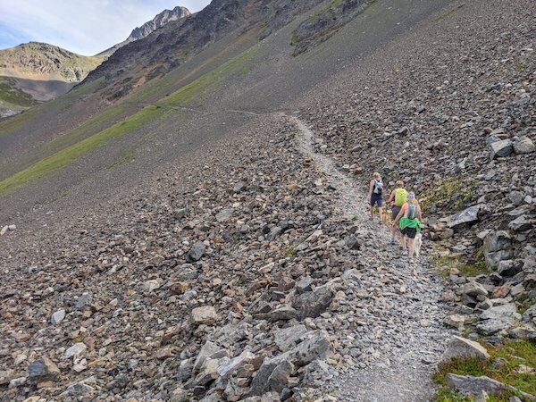
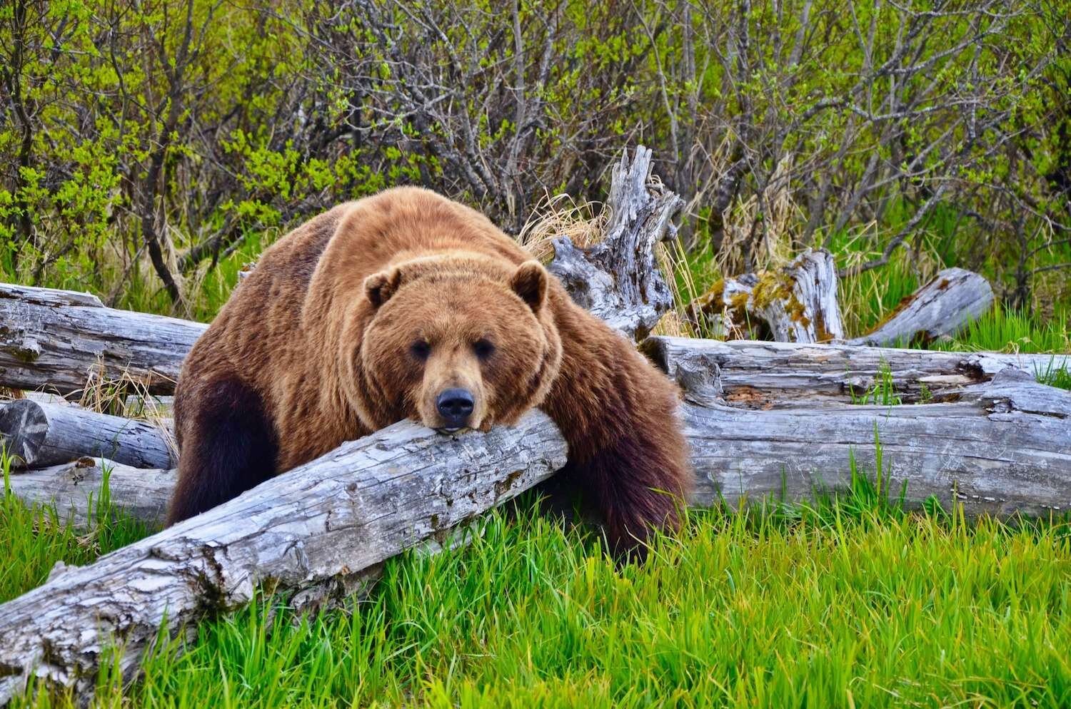
The trail is riddled with switchbacks, uneven terrain, sharp rocks, and roots that can easily trip up people once fatigued. Bear Feces are common so BEAR AWARE is critical. There are multiple cliffhanger spots that require the use of ropes and ladders and near edges that drop down to the river, so balance and sure footing are mandatory. Trail crews have situated well-placed ropes and ladders at the most tenuous places. Expect to see snow, especially the higher you climb. There are river/stream crossings without bridges and the water is cold from glacial run-off! A walking stick is not required but it may help in some of the really steep parts of the trail or when fording Eagle River. Pay attention! The trail splits and rejoins a few times. So, the best rule of thumb is to stay to the right if coming from Girdwood. The higher elevation climb will help you avoid losing the trail due to water inaccessibility.
Key Spots From Girdwood Trailhead
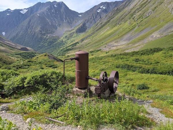
Monarch Mine/Crow Creek Cascades: 1.5 miles - The trail to Monarch Mine is a moderately steep climb. Monarch Mine operated from 1906 to 1948. Monarch Mine, along with Indian Valley Mine, were the only two lode gold mining adventures that were actively worked over a substantial period of time in Turnagain Arm. Today, all that is left are remains of the mill and crew’s quarters.
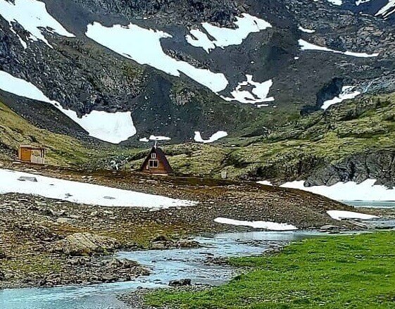
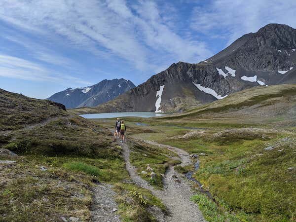
Crystal Lake and USFS Cabin: Approx 3.0 miles - Beautiful views of Crystal Lake and the only Public Forest Service Cabin to rent on the trail is at this location. You are only allowed to use it if you have a paid reservation. Also, the cabin is right on the trail so don't expect too much privacy. Go to USFS to rent it or to get more information
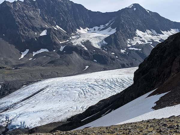
Crow Pass/Raven Glacier: Approx. 3.5 - After a 2000 foot climb in elevation, you are rewarded with spectacular views of Raven Glacier and the valleys below. It’s the highest point on the trail but well worth the rigorous climb. From here the trail begins the long descent toward the Eagle River Valley.
Clear Creek: Approx. 5.4 miles - Clear Creek is the first real water crossing on the trail hikers encounter. Avoid steep embankments and gurgling pockets of deep water and submerged boulders. Watch for ropes, rocks and fallen logs to aid the crossing, and pay attention so as not to miss the trail connection on the other side.
The Ford: Approx 12 miles - Once you reach the Ford, you are half-way through the hike. But this is where you have to cross Eagle River and it’s big! It’s more than 150 feet wide and the water is cold and fast. Fording technique is critical because the water can be waist high and chilly. Experts recommend crossing in the morning as glacial rivers swell under hot sun. Also, cross at the marked sites. They are the designated white posts.
The Final Hike: The hike from the Ford and Eagle River crossing roughly parallels the Eagle River and can be muddy. Between Twin Falls and Icicle Creek, ropes and ladders connect steep sections of the trail Around mile 18 are Heritage Falls and another established campsite. The final miles of the trail include landmarks such as The Perch (a rocky outcropping that provides a picturesque view of the valley), Echo Bend, Rapids Camp and – finally – the Eagle River Nature Center.
Day Trip from Girdwood
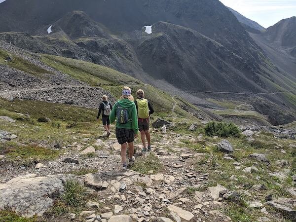
The best part of the trail is the first 3.5 miles from the Girdwood Trailhead. The second half of the trip, closer to Eagle River Nature Center, is underneath canopy or chest high foliage. So, if you only have limited time, hike to the pass and explore the trails around Crystal Lake and Raven Glacier. While this is the steepest part of the whole trail, the round trip can still be completed in 2-4 hours.
The first mile of the trip you will travel through high foliage. At the 1.25 mile mark, the trail splits and there is a sign. The left takes you to Monarch Mine and then to the pass. The right takes you uphill via a series of switchbacks. Both trails take you to the pass. The Monarch Mine trail is steeper while the switchback offers a more gradual climb. Most people take the switchback trail to the pass and then return on the Monarch Mine trail.
Winter Hikes
While Crow Creek is opened all year long, hikers do so at their own risk. in addition, many areas are impassible during the winter because of snow. This is a high avalanche area so avalanche rescue training and beacons are highly recommended. Check openings before venturing on this trail as Forest Service will close it during high Avalanche snow conditions.
Considerations
Remember that bears love berries. So being Bear Aware is critical to planning and executing this hike. During the planning stages, check the weather to make sure it’s not raining too hard because Eagle River will be even more difficult to cross. Be exceptionally careful if you decide to visit Raven Glacier. Do not travel on the glacier as snow could be hiding a deep crevasse. Be prepared for emergencies, carry a weapon/bear mace, carry a satellite phone (cell phones won’t work), and file a trip plan with a friend. Use water purification techniques for drinking water to avoid contracting Giardiasis. If you plan on hiking the trail on the weekend, with a sunny day, expect a very full parking lot. Go early to get a spot!
To plan your trip, use this MAP produced by Chugach State Park.
Guided Tours to Make your trip even more Special
Chugach Adventures can create a special trip for you through Crow Pass or any other location in the Chugach Mountains. They are the local experts and can guide you on a camping, hiking, or rafting trip.


